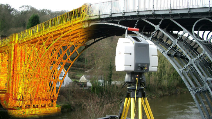
Laser scanning is a land surveying method that has gain rapid popularity for its ability to collect data from objects, surfaces, buildings, and landscapes in the form of point cloud data, which is essentially millions of 3D coordinates to create digital 3D models of the scanned environment.
The first recorded use of laser scanning dates back to the 1960s. The equipment used back in those days was fairly rudimentary, comprising of cameras, projectors, and lights. As you can imagine, these first scanning systems were quite slow when it came to processing data, which is why they were replaced by LiDAR systems – high-quality scanners that use laser beams and shadowing to collect data relating to objects and surfaces, in 1985.
How Does Laser Scanning Work?
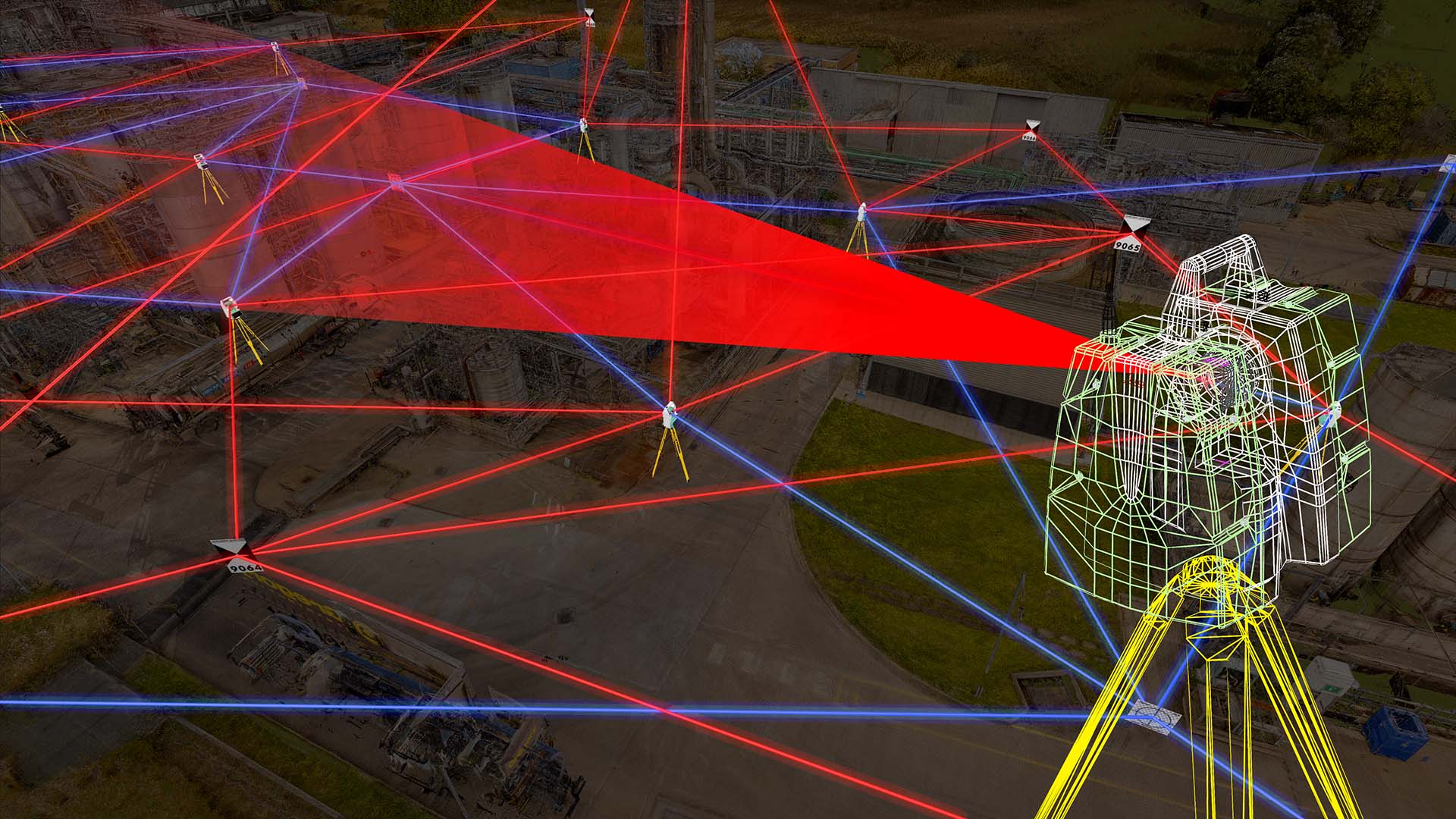
Present-day laser scanning procedures use laser beams, advanced sensors, Global Positioning Systems (GPS), Inertial Measurement Units (IMU), receiver electronics, and photodetectors. Using all these components, laser scanners can calculate accurate coordinates of surfaces and structures.
First, laser scanning systems throw out light waves that bounce off surfaces and reflect back to the sensor. The sensor then calculates how far away the surface is by measuring the time taken for the light beam to complete its journey. This process is known as the “time of flight” measurement. The distance measured is then used to calculate a coordinate for the tiny section of the surface hit by the laser beam. All of this happens in just seconds, and during a single scan, a laser scanner will collect millions of 3D coordinates.
When the point clouds from laser scans are processed, they form a digital representation of the scanned surfaces, demonstrating the dimensions and spatial relationships of topographic features and structures.
The Advantages of 3D Laser Scanning
Laser scanning has several advantages over alternative land surveying methods, such as photogrammetry. Here are some of the reasons why organizations like Flat Out Surveying use 3D scanning for surveys:
- Laser Scanners Can Collect Data Quickly
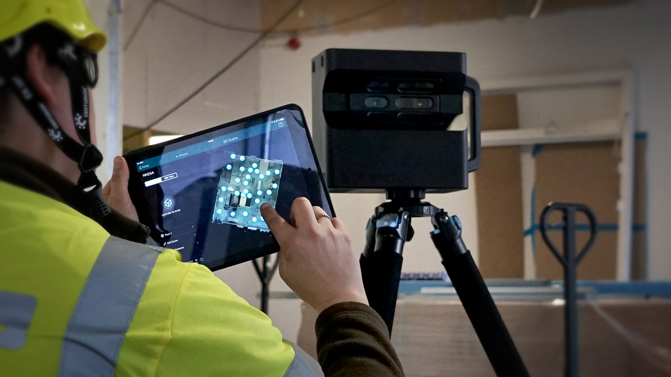
Laser scanning is the speediest land surveying method out there. Laser scanners can collect millions of data points in seconds, reducing the time and human resources needed to complete surveys. This method of surveying is perfect for projects that require a quick turnaround.
- Systems Can Be Mounted to Vehicles
For projects that require information from vast landscapes or extensive networks of roads or railroads, laser scanning systems can be mounted onto land-based or aerial vehicles. The systems can then gather data from all the necessary areas in a short space of time.
- Laser Scanning Can Reduce Health and Safety Risks
Using laser scanners to collect information from dangerous or hard-to-reach locations means teams don’t have to put themselves at risk. Instead, surveyors can stay safely out of harm’s way while the scanner does its job.
- 3D Scanning Systems Can Survey Inaccessible Areas
Before laser scanning systems came about, certain areas were off-limits to surveyors. But with vehicle-mounted LiDAR systems, organizations can collect point cloud data from even the most inaccessible of areas. For example, drone-mounted LiDAR can survey unsafe sites and structures. Also, laser scanning is a non-contact surveying method, so it can also survey sensitive objects or areas, such as vulnerable historic sites.
- Detailed 3D Models Can Be Created from Scan Data
Perhaps the biggest advantage of laser scanning is that scan data can create 3D CAD models. These 3D digital models can be used to analyze topographic features, structures, and transport corridors. They can also be used to simulate construction or urban planning projects.
Applications of Laser Scanning
Laser scanning is utilized by many high-value, government-backed, and privately funded projects such as national defence and road surveying. Some of its other well-known applications are listed below.
Spatial Scanning: Laser scanners not only reduce the time taken in plotting and spatial scanning but also improve the planning process and considerably cut down the number of errors during the data collection. Because of the value laser scanners add to spatial scanning, researchers use them for mobile mapping, surveying, scanning buildings — and their interiors.
Road Surveying and Traffic Construction Analysis: Developing highways is one of the most challenging tasks for authorities as they can’t stop traffic for too long to gather information about existing roads — but they can’t delay construction work either. Laser scanners help reduce turnaround time for road surveys and traffic construction analysis from weeks to a matter of hours.
Urban Topography: Urban topography is an interdisciplinary study of towns — their forms, layouts, architectural history, geography, etc. — for town planning. This is a critical process as it requires regular, accurate data collection by urban planners who use laser scanners to collect and process data before beginning development work.
Laser scanning can also be applied to civil surveying, reverse engineering, mining, and archaeological projects. It plays an important part in most civil engineering-related projects and helps governments and private authorities accomplish tasks on time and with 100% accuracy.
We hope the article above has given you some insight into the usefulness of laser scanning for surveying purposes. Do you have further queries, or insight of your own to share? Be sure to leave them in the comments section below.


