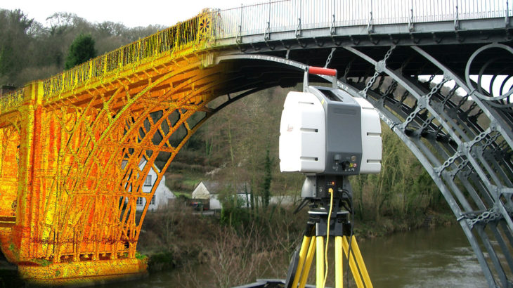
Laser scanning is a land surveying method that has gain rapid popularity for its ability to collect data from objects, surfaces, buildings, and landscapes in the form of point cloud data, which is essentially millions of 3D coordinates to create digital 3D models of the scanned environment. The first recorded use of laser scanning dates […]


