
Property and land surveying stands as a cornerstone in real estate, construction, and urban planning. By providing precise measurements and vital data about land and its features, surveyors play a critical role in property development, legal property descriptions, and overall land management. This article explores the varied facets of property and land surveying, emphasising the importance of professional surveying in projects that involve land use and ownership.
Understanding the Role of a Surveyor
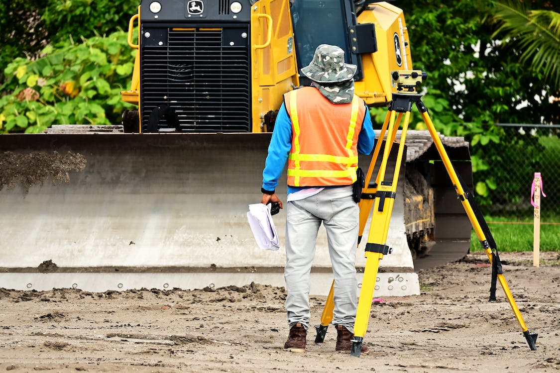
Surveyors are professionals trained to accurately measure and map property boundaries. They utilise a combination of traditional tools and advanced technology, such as GPS, drones, and laser scanning devices, to create detailed surveys. These surveys ensure that property transactions are conducted fairly and legally, and help in planning and executing construction projects without encroaching on neighbouring properties.
The Precision of Land Surveying
Land surveying is a meticulous process that determines the exact boundaries and physical features of a property. Surveyors set out to document the dimensions, gradients, and size of land parcels. This information is crucial for several reasons, including property disputes, development permissions, and infrastructure planning. A precise land survey gives property owners and developers the confidence to make informed decisions regarding their land.
The Evolution of Technology in Surveying: Drone Mapping and Laser Scanning
Drone mapping and laser scan surveying represent the cutting edge of surveying technology. Drones provide a bird’s-eye view of large areas, making it possible to conduct surveys and inspections of hard-to-reach places or large parcels of land quickly and efficiently. This technology is particularly useful in topographic surveys, environmental studies, and urban planning.
Laser scanning, on the other hand, offers unmatched accuracy in detail-oriented projects. This method uses laser beams to create highly detailed three-dimensional models of structures, landscapes, and even entire cities. Laser scan surveying is invaluable in historical preservation, construction, and industrial design, where precise measurements are crucial.
The Critical Role of Property Surveyors
Property surveyors specialise in defining property boundaries. Their work is essential in resolving property disputes, establishing real estate boundaries for sales or development, and ensuring regulatory compliance in new constructions. They work closely with legal teams, architects, and local governments to ensure that the details provided in their surveys are recognised and respected in legal and commercial contexts.
Legal Implications and the Importance of Accurate Surveying
Accurate surveying is not just a technical requirement but a legal necessity. Incorrect boundaries can lead to disputes with neighbours, legal challenges, and potential financial losses. In some jurisdictions, the law requires a certified survey before any property development or high-value real estate transaction can proceed. Thus, engaging a qualified and experienced surveyor is essential for any project that involves land alteration or ownership transfer.
The Future of Surveying: Integration of New Technologies
The future of surveying is being shaped by the integration of new technologies like augmented reality (AR), big data, and continuous advancements in drone and laser technology. These tools will further enhance the accuracy, efficiency, and scope of surveying services, allowing surveyors to deliver more detailed insights and quicker results. As technology evolves, the surveying profession must adapt and adopt these innovations to meet the increasing demands of sophisticated architectural, engineering, and construction projects.
In conclusion, property and land surveying is an indispensable part of managing, using, and transacting real estate and land. It provides a critical foundation for legal certainty, planning precision, and efficient development. Whether through traditional methods or innovative technologies like drone mapping and laser scanning, surveyors ensure that land-related decisions are made with the best available information.
Hope you’ve found this post helpful and enjoyable. Feel free to share your thoughts in the comments below. For anyone involved in property development, construction, or legal land matters, understanding the value and function of thorough surveying is not just beneficial—it is essential.


