In the expansive and diverse landscapes of Australia, the role of surveying experts has never been more crucial. From the bustling cities to the remote outback, surveyors are the unsung heroes shaping the future of development, conservation, and land management. This article delves into the cutting-edge world of Australian surveying, exploring the expertise and technologies driving the industry forward.
Surveyor: The Foundation of Precision
Crafting the Lay of the Land
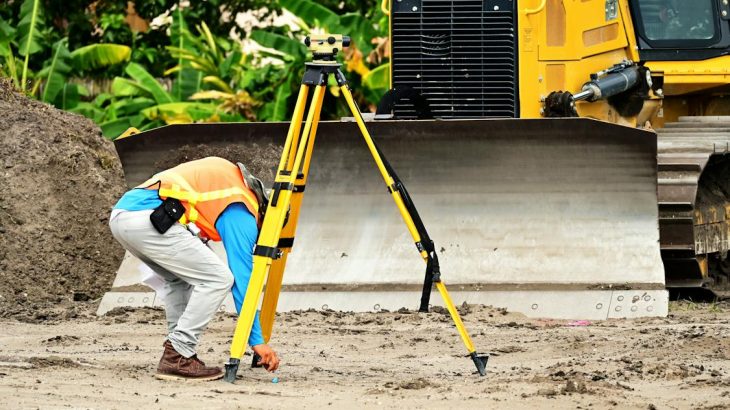
At the heart of every construction project, land development, or environmental conservation effort is a surveyor. These professionals possess a deep understanding of land characteristics, legal property boundaries, and the principles of mapping. By combining traditional techniques with modern technology, surveyors in Australia provide the accurate, reliable data that forms the foundation of planning and development across the country.
Land Surveyor: Guardians of the Ground
Navigating Australia’s Diverse Terrain
Land surveyors specialise in determining the terrestrial or three-dimensional positions of points and the distances and angles between them. In Australia’s varied terrain, from its coastal fringes to its desert heart, these experts play a pivotal role. They ensure that land is used efficiently and sustainably, advising on the best practices for land development, resource management, and environmental protection.
Property Surveyor: Defining Boundaries
Securing Property Rights and Investments
Property surveyors focus on the legal aspects of land ownership, including boundary locations, easements, and rights of way. Their work is essential for resolving disputes, securing property rights, and guiding the development process within the legal framework. In Australia’s rapidly growing real estate market, property surveyors safeguard investments and ensure that development respects existing laws and regulations.
Drone Mapping: A New Perspective
Revolutionising Surveying with Aerial Insights
Drone mapping has emerged as a game-changer in the surveying industry, offering a new perspective on land assessment. By deploying unmanned aerial vehicles (UAVs), surveyors can capture detailed aerial photographs and generate high-resolution maps and 3D models of the terrain. This technology is particularly valuable in Australia’s remote and inaccessible areas, providing accurate data without the need for physical access to the site.
Laser Scan Surveying: The Edge of Accuracy
Capturing Every Detail with Precision
Laser scan surveying, or LiDAR (Light Detection and Ranging), uses laser light to measure distances and create precise three-dimensional models of objects and environments. In Australia, this technology has revolutionised the surveying of complex structures, historical sites, and natural landscapes. Laser scan surveying offers unparalleled accuracy and detail, enabling surveyors to capture every nuance of the terrain and built environments.
The Evolution of Surveying in Australia
Embracing Technology for a Sustainable Future
The surveying profession in Australia has undergone a significant transformation, driven by advances in technology and a growing awareness of environmental and developmental challenges. Modern surveyors are not only experts in measurement and mapping but also in the application of sophisticated technologies such as GPS, GIS (Geographic Information Systems), drone mapping, and laser scanning. These tools have expanded the capabilities of surveyors, allowing for more efficient, accurate, and comprehensive analysis and planning.
Navigating the Path Ahead
Surveying experts in Australia are at the forefront of shaping the country’s future, ensuring that development is sustainable, efficient, and aligned with the needs of both the environment and society. As technology continues to evolve, the role of surveyors will only grow in importance, offering new insights and solutions to the complex challenges of land and resource management.
Charting a Course for Tomorrow
The work of surveyors underpins the successful planning and execution of projects across various sectors, from construction and real estate to environmental conservation and resource management. By leveraging the latest technologies and their deep expertise, Australian surveyors are not just mapping the land; they are charting a course for a sustainable and prosperous future. Their contribution is essential in navigating the delicate balance between development and conservation, ensuring that Australia’s natural beauty and resources are preserved for generations to come.


